The Biggest Storm System of the Season is Coming
After knocking out power and damaging homes across Adelaide last night, a complex low pressure...
Thunderstorms are on the menu for southern Queensland and NSW this week. Kicking off late Thursday through Saturday the weather is starting to feel a little spring-like!
A strong upper trough will move across eastern Australia this week whilst interacting with an unusually high moisture content for this time of year. This moisture will help fuel the development of thunderstorms for central-western NSW and southern Queensland on Thursday, Friday, and potentially Saturday.
Late Thursday, a surface trough will move into western NSW and interact with this increasing moisture content to its east. Temperatures in the mid-level of the atmosphere (around 5-6km high) will also begin to cool rapidly, with isolated storms to develop for northwestern NSW.
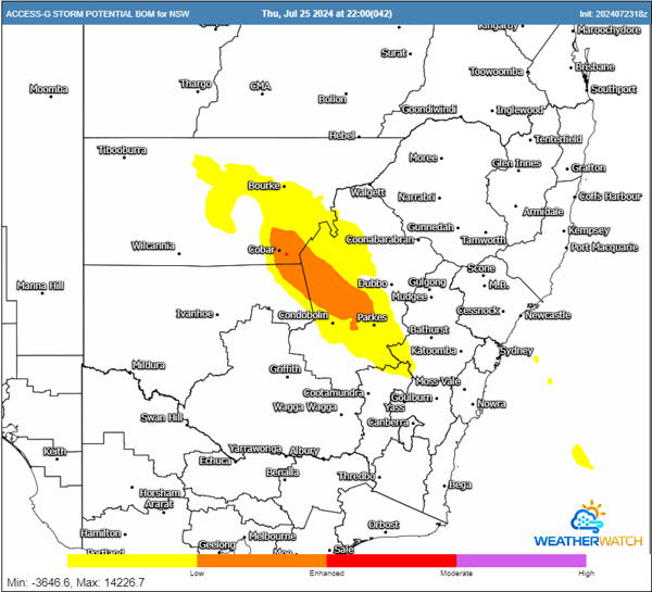
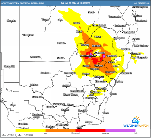
Thunderstorm potential for Thursday and Friday evening. Images via WeatherWatch MetCentre.
This system will shift further east on Friday, which will likely be the peak day for thunderstorms.
Further thunderstorms are expected to fire along this surface trough during the early afternoon through central NSW, extending north into southern Queensland. Surface temperatures will climb into the early 20s, combined with a higher-than-usual moisture content for July. Coupled with very cold temperatures aloft (-19°C to -20°C around 5-6km in altitude) and strong wind shear from the upper trough, conditions may be favourable for one or two organised storms.
A localised large hail and damaging wind threat will be possible on Friday. However, as usual with eastern Australian storm setups, a spanner will be thrown into the works.
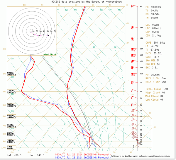
ACCESS G sounding in northern NSW for Friday afternoon. Dewpoints (left red line) into the mid-teens, cool upper temperatures, excellent wind shear and low to moderate instability (grey line).
Some forecast models suggest that the activity from Thursday evening may continue throughout Friday, meaning that ongoing cloud and/or rain may lower this potential.
The storm threat will likely diminish into Saturday, with cloudy, showery conditions the most likely outcome. Despite this, areas that can see a couple hours of sunshine may hear a rumble or two, with small pockets of hail possible.
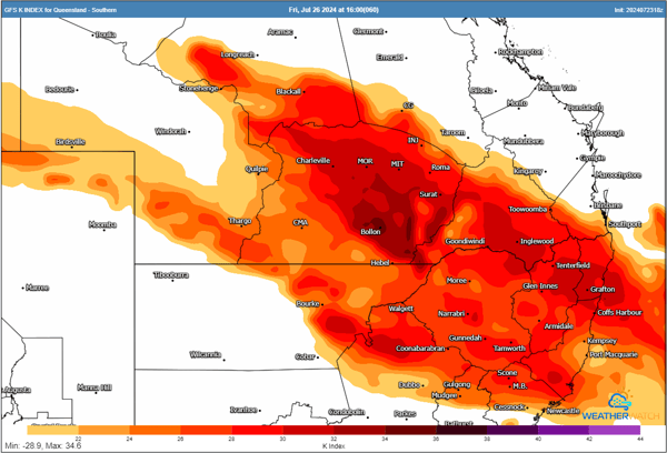
K Index for Friday afternoon. K Index is a parameter that measures potential for storms to develop based on the temperatures and dewpoint. The higher the value, the higher potential for the development of storms.
After knocking out power and damaging homes across Adelaide last night, a complex low pressure...
A weekend of storms looms for parts of Australia, with significant large hail activity forecast for...