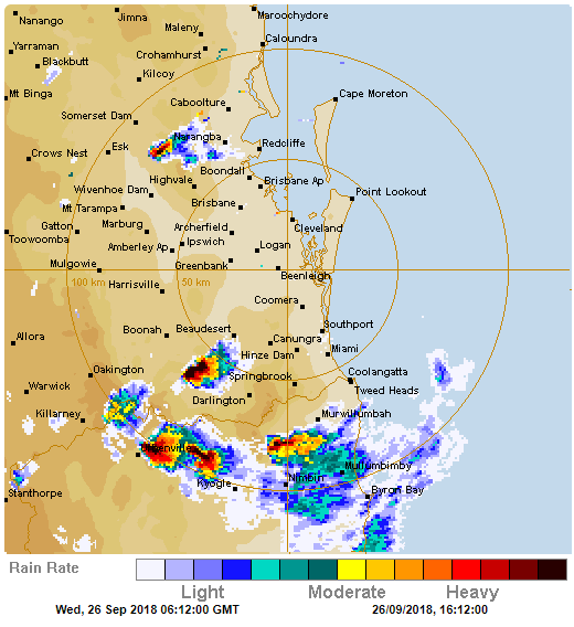
Numerous hailstorms hit parts of northeast New South Wales yesterday, with some areas receiving so much hail the ground was covered like snow.
A cold upper level airmass combined with a low pressure trough to trigger thunderstorms across the region during the afternoon and evening, with the Northern Tablelands and inland parts of the Northern Rivers seeing the most widespread activity.
Due to the cold upper level air, hail was commonplace in any thunderstorms, with reports at Tenterfield, Kyogle, Bonalbo, Green Pigeon and Drake.
The majority of this hail was small with some areas seeing hail heavy enough to cover the ground like snow, however there were reports of hail close to golf ball size near the border.
Coastal areas largely missed out, although power outages were reported in the Tweed area.
Thunderstorms will become more likely again tomorrow and on Saturday, with the chance of further hail, as well as the risk of damaging winds and heavy rainfall.
