Northern Australian monsoon set to strike this week, with heavy rainfall for Queensland and the Northern Territory
It’s been a long build-up to the monsoon for residents across northern Australia, with their faith...
Western Australia’s South West Land Division has been peppered with showers, severe storms, and heavy rainfall overnight, leading to flash flooding and record rainfall totals!
It’s not uncommon for Western Australia to see severe weather at this time of year, but what is unusual about the latest spate of rain is the intensity of the falls during the past 12 hours.
Widespread rainfall totals of 27-75mm have impacted the region as a trough and cold front passed over. A severe thunderstorm warning was issued just before 7pm local time last night for heavy rainfall, before being upgraded to include localised intense rainfall with the potential to produce life-threatening flash flooding.
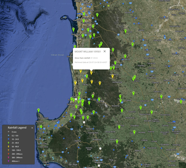
Rainfall totals to 9am Tuesday 23/07/2024. Image via EWN
Mount William saw the largest rainfall total, picking up 91mm and registering a new rainfall record for this site. Despite Mount William’s records only stretching back to 2004, this was its heaviest daily rainfall total in history, eclipsing the 88.4mm that fell on September 21st, 2017. 52.2mm fell within two hours to 9:45 pm local time.
Other notable totals include.
Rapid river rises and flash flooding was observed, however, no rivers exceeded minor flooding during the overnight deluge.
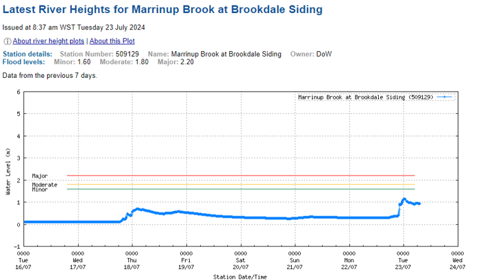
Marrinup Brook at Brookdale registered a rapid river rise overnight. Image via BoM.
After months of drier-than-usual conditions, the last few months have seen rainfall return to the region, with increasing totals during the past three months. Perth Metro registered 123mm through July 23rd, just 23.3mm shy of its July average.
With a persistent stream of onshore southwesterly winds and showers over the coming days, further accumulated totals of 10-20mm will be possible. Another substantial frontal system will also impact the southwest during the weekend with a reinvigorated band of rainfall.
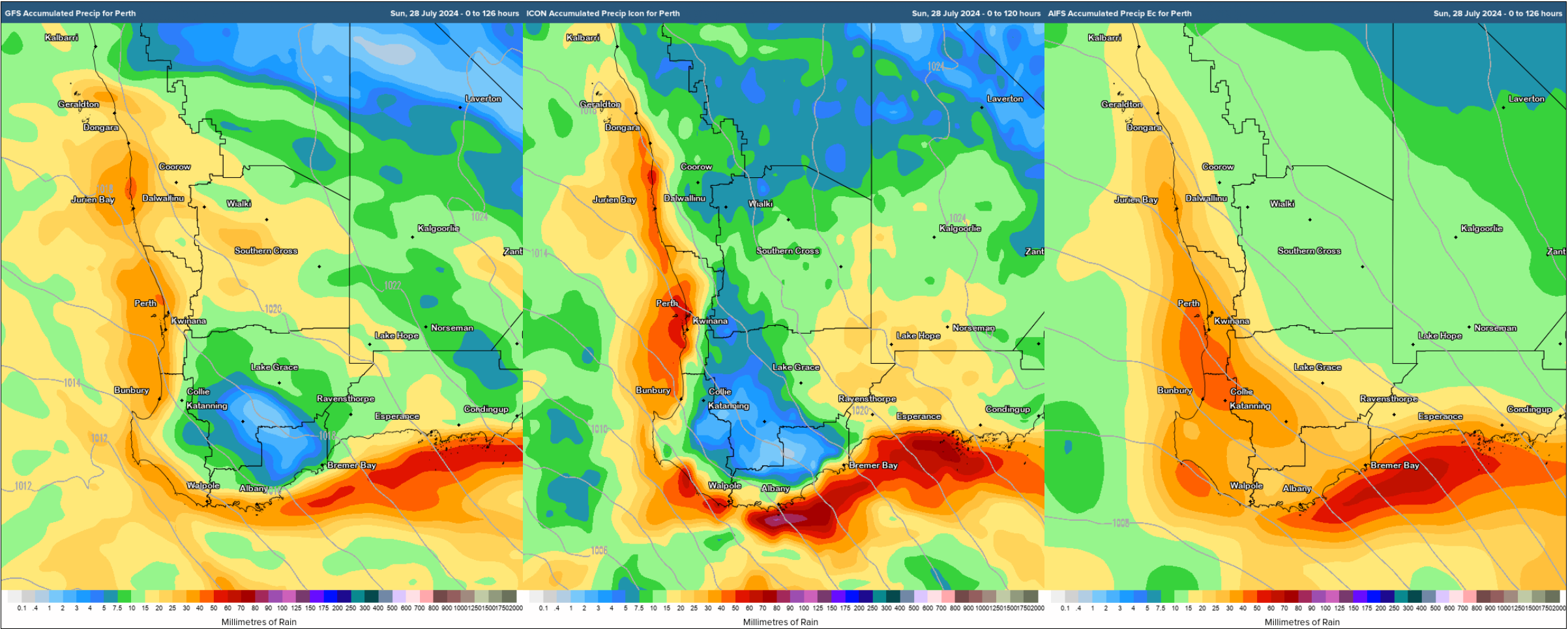
GFS, ICON, AIFS forecast rainfall next 4-5 days. Image via WeatherWatch MetCentre.
It’s been a long build-up to the monsoon for residents across northern Australia, with their faith...
It’s rinse and repeat for inland Australia, with the third flood event of 2024 inundating western...
The Southwest of Western Australia, including the unique Margaret River region, has been...