This is not a drill; Rainfall will increase across parts of Queensland and NSW over the next week. But wait, there is a catch.
Whilst Australia has been in the grip of a crippling dry spell thanks to the combination of El Niño and a positive Indian Ocean Dipole (IOD), there are increasing signs of moisture returning for eastern Australia. A pattern flip is well and truly underway, with model agreement signalling a continued run of widespread showers, and storms, tending to rain periods across Queensland and NSW over the next 7-10 days, extending into parts of Victoria and even Tasmania. This multi-day storm outbreak will provide an overdue, welcome drink for hundreds of thousands of people.

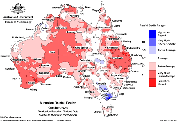
October Rainfall Deciles across Australia. Image via BoM.
Scattered showers and severe storms returned to the Wide Bay and Burnett region on Wednesday afternoon with more to come on Friday. The south-easterly change was the focus for Wednesday’s storms, with winds shifting northeast across inland Queensland late Thursday, pouring moisture-laden air into the region and aiding in developing a dryline (a boundary separating dry air and moist air). This moisture will be driven inland as a blocking high set up in the eastern Tasman Sea over the weekend, maintaining an east-north-easterly flow.
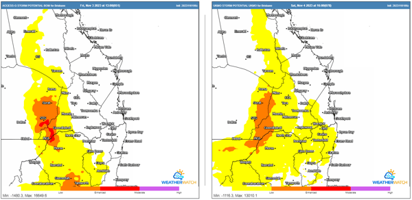
Showers and isolated weak storms may begin to develop in response during the morning hours of Friday across central and southern Queensland before more robust storm activity forms along the dryline during the afternoon. Severe storms are possible, with damaging winds and large hail the primary threats, although, locally moderate rainfall totals will be possible under storm activity. Storms will weaken into the evening before spreading into areas of light rain for many.

Thunderstorm potential for Friday and Saturday (ACCESS G and UKMO). Image via WeatherWatch MetCentre
It’s a case of rinse and repeat for the area on Saturday, although wind shear will increase - enabling storm organisation during the afternoon hours, with large hail, damaging winds, and heavy rain a threat. Once again, storms are expected to weaken into the evening and eventually spread out into areas of light rain.
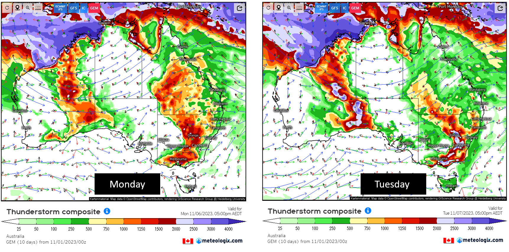
Storm activity will contract towards eastern Qld and northern NSW on Sunday, with instability increasing once again on Monday, with widespread showers and storms continuing. These storms will be slow-moving due to a lack of wind shear, meaning that clusters of storms will have the potential to produce moderate to locally heavy rainfall.
Convective rainfall of this nature can lead to hit-and-miss rainfall totals. Numerous locations across eastern Qld and NSW are expected to receive at least 5-10mm, with some regions expected to pick up 20-40mm, with heavier falls likely. This rainfall won’t alleviate long-term drought issues, but it’s a start.

Accumulated precipitation next 8-days. EC/GFS/ACCESS G. Image via WeatherWatch MetCentre
This is fantastic news for many across this region. Not only have the areas of southern-inland Queensland and northern NSW been under attack from fires of late, but drought-like conditions have been impacting the region for the last 6-12 months.
For those wanting rain, there is even more good news. The model agreement is signalling a continued run of widespread showers and storms across Queensland and NSW next week, which will extend into parts of Victoria and even Tasmania.

Thunderstorm composite for next Monday and Tuesday. Image via Meteologix