A dangerous mix of severe weather will strike western and southern parts of Western Australia overnight Friday through Saturday. Heavy rain, damaging winds, and severe storms are all expected as a vigorous cold front impacts the state.
With the passage of this system, widespread showers, rain periods, and severe thunderstorms are expected to develop, along with a vast swathe of gale-force winds that will spread through the state's interior on Saturday.
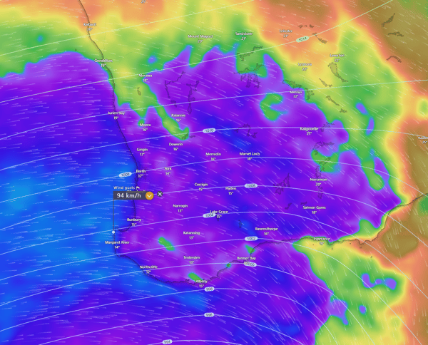
On Saturday morning, coastal regions will experience wind gusts of up to 90km/h, with gusts reaching up to 110km/h at times. A vast swathe of gale-force winds will also spread through the state's interior. These wind gusts can bring down trees and powerlines, making the Aussie favourite, the trampoline, a potential missile.

EC Potential wind gusts for Saturday morning for Western Australia. Image via Windy.com
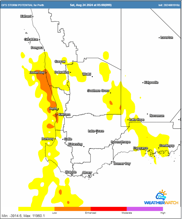
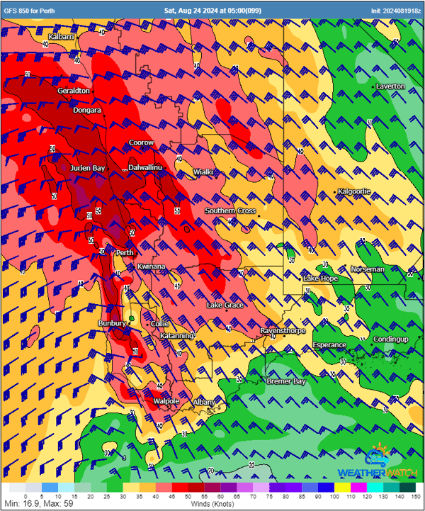
A band of thunderstorms will also develop with the passage of this front. A region of powerful winds about 1.5km above the surface may be dragged down to the surface with storm activity, with isolated wind gusts to 120km/h possible within storms. During this time of year, with fronts this powerful, there is always the threat of an isolated tornado or two about the coastal fringe.

GFS thunderstorm potential for Saturday morning. Image via WeatherWatch.

850mb winds (about 1.5km above the surface) potentially mixed down with storm activity. Image via WeatherWatch.
Heavy rainfall will also accompany this frontal system, with the potential for 20-40mm, with isolated heavier totals to 60mm, particularly under storm activity. This type of rainfall will lead to flash flooding.
Given the intensity and widespread nature of this weather system, it is essential for residents and businesses in the affected areas to take precautions. EWN offers comprehensive severe weather alert services that can help you prepare for and respond to these dangerous conditions.
Our advanced monitoring and alerting systems provide real-time updates, ensuring that you are informed of any changes in weather conditions as they happen. With EWN’s services, you can receive customised alerts tailored to your location, helping you stay ahead of potential risks such as damaging winds, flash flooding, and severe thunderstorms. Our platform also integrates the latest in flood modelling research, offering detailed insights into flood risks, which is crucial during heavy rainfall events like this.
By staying informed with EWN, you can take proactive measures to secure your property, protect your loved ones, and minimise disruption to your operations. Don’t wait until it’s too late—subscribe to EWN’s alert services today and be prepared for whatever nature throws your way.
Stay safe, and remember, when it comes to severe weather, early warning saves lives.