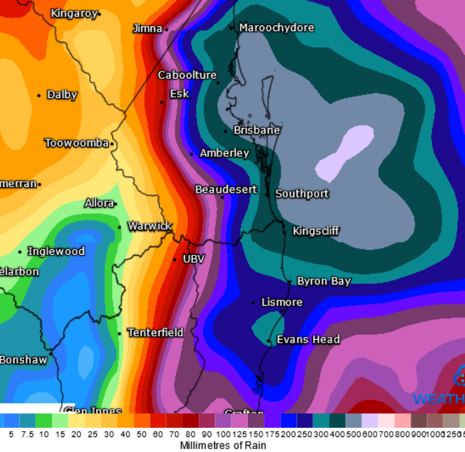
South East Queensland is on flood alert with a significant rain event developing.

A strong upper trough and associated cut-off low will move slowly east across southern Queensland today. A surface trough near the Southeast coast will deepen in response to this upper system.
Heavy rainfall leading to flash flooding and riverine flooding is expected on Wednesday, Thursday, and Friday, with the potential for life-threatening flash flooding to develop, particularly with convergence bands and thunderstorms. Widespread falls of 100-200mm is expected from Gympie to Byron Bay, with locally intense falls of 200-500mm.
A severe weather warning remains in effect for the southern Wide Bay & Burnett, eastern Darling Downs, and South East Coast forecast districts for intense rainfall, with a severe weather warning current for heavy rainfall across parts of northern NSW.
Overnight, intense falls were recorded across parts of the Sunshine Coast and southern Wide Bay, with Mount Wolvi (east of Gympie) registering a staggering 392mm, most of which fell within a 3-6-hour period. Other notable totals include:
- Cedar Pocket 352mm
- Pomona 350mm
- Cooran 322mm
- Black Mountain 312mm
- Pelican Waters 170mm
- Nambour 169mm
- Mt Cotton 100mm
To discuss how we can help your business call (02) 6674 5717, email support@ewn.com.au, or contact us via our enquiry page here.