Thunderstorms will return to the southern states this week bringing the threat of large hail, damaging winds, and heavy rainfall.
A trough of low pressure residing across inland NSW, and Victoria will be the focus for scattered to widespread storm activity on Tuesday afternoon and evening. Whilst all eyes will be focused on a race that stops the nation - attention will quickly turn to the sky with the prospect for severe storms to impact Melbourne later this afternoon. Damaging winds and large hail will be possible during the late afternoon and evening.
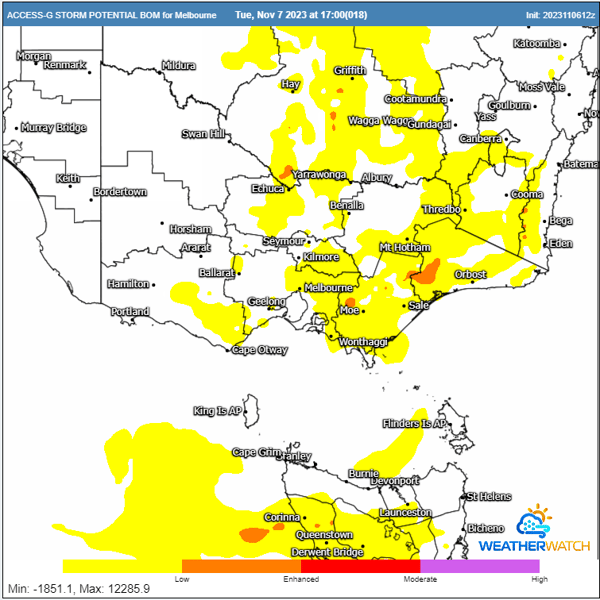
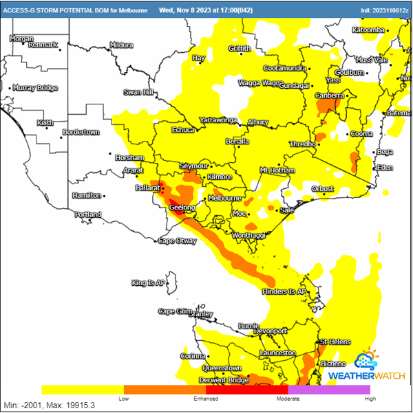
Thunderstorm potential for Tuesday and Wednesday. Images via WeatherWatch MetCentre.
Thunderstorms aren’t the only threat across the state today. The Victorian District Grass Pollen Forecast is set to extreme across the entire state today with the Epidemic Thunderstorm Asthma risk forecast to hit moderate also.
What do the risk forecasts mean?
The epidemic thunderstorm asthma risk forecasting system combines the forecasting of a certain uncommon type of thunderstorm and forecasting of grass pollen levels across Victoria.
It spans three days (today, tomorrow, and the day after) and uses a colour-coded scale from low to high risk: green (low), orange (moderate), and red (high).
- A low-risk (green) forecast means that the elements necessary for an epidemic thunderstorm asthma event are not expected and an event is unlikely.
- A moderate risk (orange) forecast means that one of the elements necessary for an event may be present (i.e. a high pollen forecast or a severe thunderstorm with strong winds) and there is a moderate chance of an epidemic thunderstorm asthma event occurring.
- A high-risk (red) forecast means that there is a high pollen forecast and severe thunderstorm(s) with strong winds are likely to be present increasing the risk of an epidemic thunderstorm asthma event occurring.
Forecasts are not a formal 'warning' and are designed to inform people at risk that they should be prepared. The forecast only indicates whether the chance of an epidemic thunderstorm asthma event occurring is increased – a higher forecast does not mean that an event is certain to happen, nor does a lower forecast mean that an event will not happen.
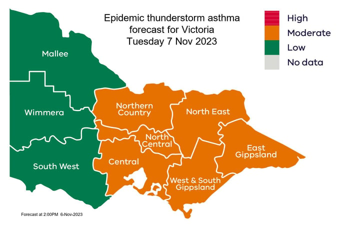
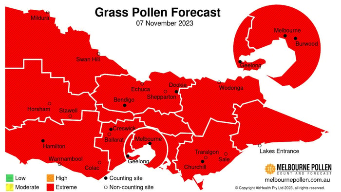
The above information and images from Epidemic thunderstorm asthma risk forecast | health.vic.gov.au
This trough will remain stationary across the state into Wednesday, with a renewed threat for severe storms to develop, with damaging winds, large hail, and heavy rainfall all possible – with the Melbourne CBD in the firing line.
Meanwhile, storm activity is expected to develop across parts of Tasmania today, chiefly across central Tasmania and across the higher peaks. Although activity isn’t expected to be as widespread or severe unlike across Victoria, moderate rainfall totals and gusty winds can be expected.
Instability will increase across Tasmania into Wednesday with scattered-to-widespread storms likely. Damaging winds, heavy rainfall, and localised large hail is expected, with Hobart a chance of seeing a severe storm or two throughout the day.
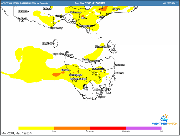
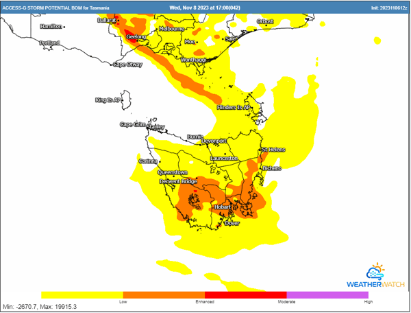
Thunderstorm potential for Tuesday and Wednesday. Images via WeatherWatch MetCentre.