A vigorous cold front will sweep across south-eastern Australia on Monday with a significant band of snow to affect alpine regions of southern NSW, Victoria, and Tasmania.
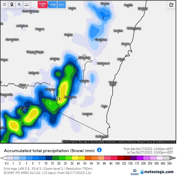
Accumulated 7-day totals of 40-60cm can be expected, chiefly for the major ski fields of Victoria and NSW, with western parts of Tasmania expected to see up to 25cm. Whilst this is expected for ski resorts across this region at this time of year, it’s the lower elevated regions which may steal the show. Parts of the Blue Mountains of NSW may see 3-8cm of snow over the next 72-hours.

Total snow accumulation next 7-days. Image via Meteologix.com
This type of snowfall doesn’t seem extreme, however, in regions like the Blue Mountains and the Barrington Tops, these events can cause havoc.
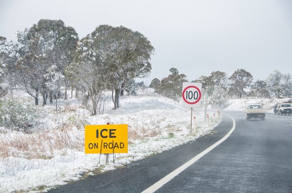
Snow events of this nature can cause significant road closures, particularly for any major roads and highways for elevated regions above 900m across the Blue Mountains late Monday into Tuesday morning. Icy roads will make driving across this region dangerous, with delays to train lines also expected.
 Ice and snow inundate parts of NSW. Image via EWN's Michael Bath
Truck routes would be severely impacted with road closures due to snowfall, with up to 24-hour delays on supplies to and from Sydney and surrounding regions.
For detailed forecasts to assist in your route planning, get in touch with us now.