Australia’s Tropical Cyclone season has officially begun, running all the way through until April 30, 2024. So, how's the 2023 - 24 outlook looking?
The last two years have witnessed Australia experiencing La Niña weather patterns. La Niña typically intensifies Australia's Tropical Cyclone season by providing more conducive conditions for their development, such as warmer sea temperatures and increased moisture. This often leads to a higher number of cyclones, some of which may be more intense and bring increased rainfall, posing greater risks of flooding and storm damage. On average, Australia usually sees 11 tropical cyclones form in our area of responsibility (long-term average) although this number has dropped to 9 since the year 2000, with 4 usually crossing the Australian coastline each season since.
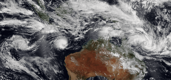
 Three tropical systems near Australia on 8 February 2023. From left to right, they are: Tropical Low 11U (later Dingani), Severe Tropical Cyclone Freddy, and Tropical Cyclone Gabrielle. (Image via NASA)
With the current El Niño and positive Indian Ocean Dipole (IOD) phases ongoing, what does that mean for the upcoming Tropical Cyclone Season?
El Niño seasons tend to favour a reduced number of tropical cyclones compared to the long-term average, with the first coastal crossing of the season tending later also. A decrease in tropical lows also occurs during El Niño years compared to neutral or La Niña years. The Bureau of Meteorology has stated in its Australian Tropical Cyclone season long range forecast that "There is likely to be a below average number of tropical cyclones for the 2023–24 Australian tropical cyclone season (November to April)"
.png?width=600&height=450&name=WESTERN%20REGION%20(1).png)
Tropical Cyclone averages by region. Image via EWN
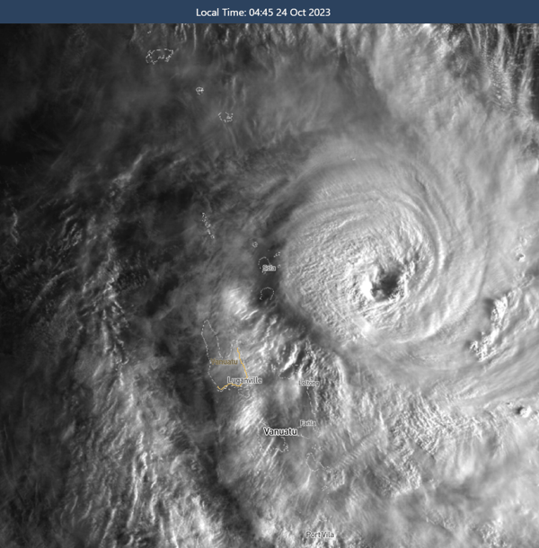
That doesn't mean that residents in areas prone to cyclones can relax, though. Ignoring the outlook was severe category 5 Tropical Cyclone Lola. Lola developed on Sunday 22nd October and rapidly intensified, reaching category 5 status (with wind gusts over 260km/h) and carving a path of destruction across the South Pacific Island chain of Vanuatu. Lola was officially the earliest category 5 system on record for the Southern Hemisphere. Thankfully, Lola remained well east of Australia, before rapidly weakening.

Severe Tropical Cyclone Lola barrels towards Vanuatu. Image via WeatherWatch MetCentre
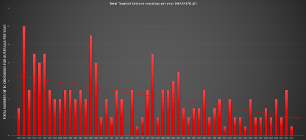
Overall, since 1970, there has been a dramatic decrease in tropical cyclone crossings across Australia, which some argue is due to a changing climate. While the relationship is complex, some studies suggest that climate change may be influencing the number and intensity of cyclones. Warmer sea surface temperatures can lead to more intense storms, but changes in atmospheric circulation could also be causing shifts in their tracks, potentially leading to fewer landfalls.

Coastal crossing for tropical cyclones from 1970 - 2023. Image via EWN
The positive Indian Ocean Dipole (IOD) event will peak over the next few of months before returning towards neutral values from February on, with a higher probability of tropical cyclone formation likely off the NW Western Australian coastline.
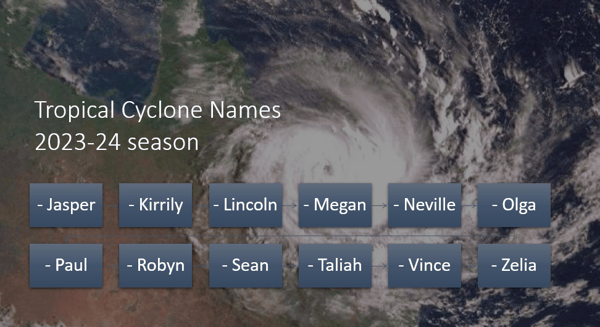
While we are yet to see our first cyclone of the season, we know that the first tropical cyclone name in Australian waters for the 2023-24 season will be Jasper.
The Bureau of Meteorology names tropical cyclones that form in the Australian area of responsibility. Should a tropical cyclone form outside of this region - it will be named by Indonesia or Fiji. A cyclone will keep its name even if it moves from this region into Australian waters. For example, Fiji named Tropical Cyclone Yasi back in 2011. Naming tropical cyclones (bom.gov.au)

At Early Warning Network, we have a comprehensive Tropical Cyclone package that we provide to clients to ensure their operations are ready and experience minimal damage to their operations. If you would like to know how we can help your business this Cyclone Season, please let us know.