It was the most hotly-discussed weather content on the internet for the better part of a week, and it arrived with a vengeance.
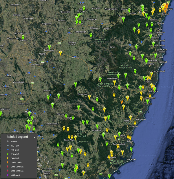
A unanimous cheer was heard across northern NSW last night as much-welcomed October rainfall drenched the region. Widespread rainfall totals of 50-120mm were registered across northern NSW in the 24 hours to 9 am this morning. Moral Creek, southwest of Port Macquarie picked up an impressive 136mm.
Other notable totals include:
- Comboyne Public School 122mm
- Sawtell 127mm
- Coff Harbour AP 102mm
- Port Macquarie 67mm
- Alstonville 66mm
- Lake Ainsworth 70mm
- Armidale 35mm
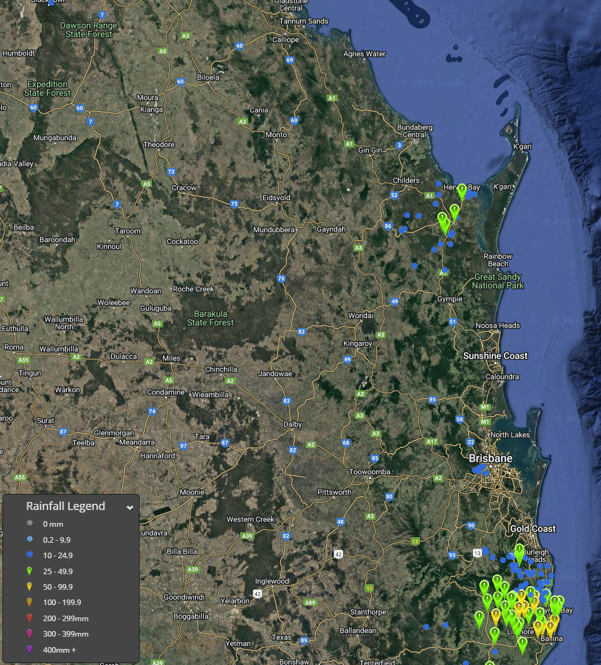
Southern Queensland also saw rain, although totals weren’t nearly as significant with falls remaining below 15mm across the region with Upper Springbrook the exception, scoring 26mm, with the Brisbane CBD registering just 5mm. Further north in the southern Wide Bay and Burnett region, multiple thunderstorms produce solid totals, with Mungar Gayndah Street picking up 33mm, Owanyilla 25mm, Portside 39mm, and Black Swamp 25mm.


Rainfall totals to 9am 27/10/2023. Image via EWN
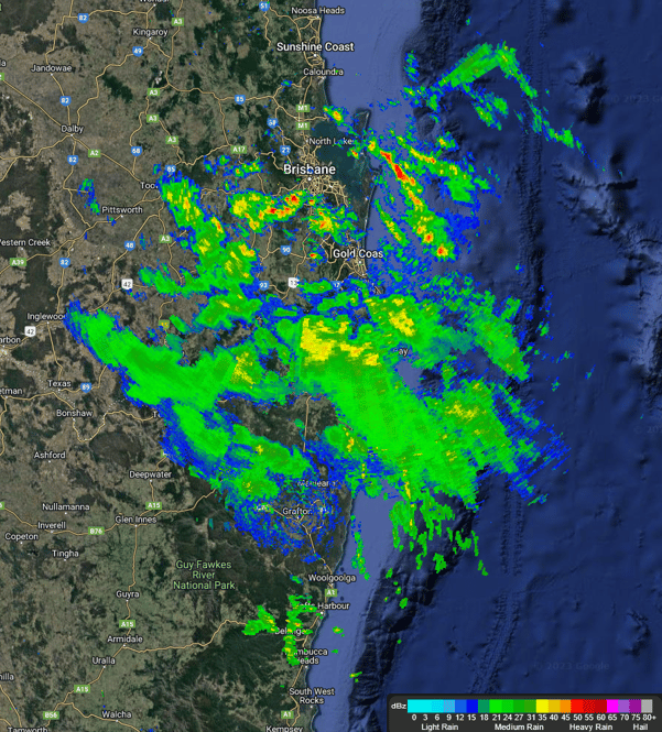
The good news is that rainfall has continued across northern NSW today, with parched regions seeing solid back-up totals with another 10-25mm already being recorded. Shower activity is increasing across Southeastern Queensland too, with the radar looking as colourful as it has in months!

Current radar image 12:45pm AEST. Image via EWN