As Tropical Low 90P, currently located 1160km ENE of Cairns, continues its journey, our attention is squarely focused on its potential evolution into Tropical Cyclone Kirrily. Expected to strengthen over the next 48-72 hours, Kirrily could become a significant weather event by Sunday or Monday. For businesses and local governments, understanding and preparing for such events is crucial.

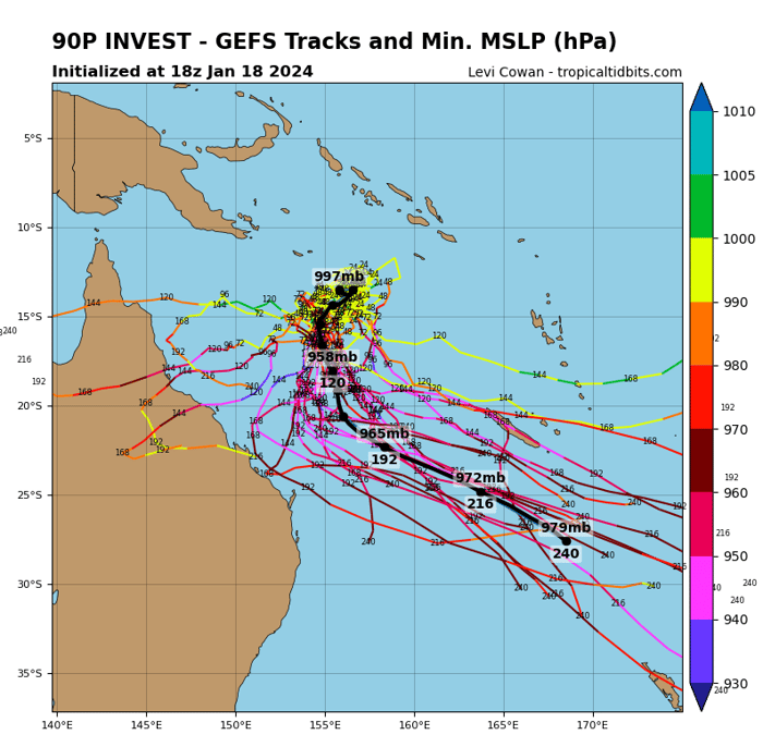
GEFS Ensemble tracks. Image via Tropical Tidbits
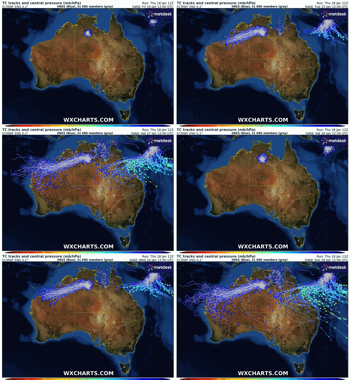
Kirrily will continue to drift in a west-southwesterly direction into the eastern Coral Sea, with further intensification expected during this period, likely reaching severe category next week. Significant doubt about its movement exists beyond the next several days, with forecasting predictions varying between a westerly and southeasterly trajectory post-Monday.
This system is being watched closely, particularly by those in North Queensland, with many nervous residents bracing for the worst. While Kirrily isn’t expected to hit Cairns or surrounding areas, continued heavy rainfall from the recent monsoon, hot on the tail from the devastation left behind by Tropical Cyclone Jasper, has residents rightly on edge.

ECMWF Ensemble Storm Tracks. Gif via WXCharts
With such uncertainty regarding this system, let’s look at the current situation:
- Development: Tropical Cyclone Kirrily is expected to form over the weekend or early next week.
- Intensity: Likely to escalate to a severe category by mid next week.
- Path: Potentially crossing the Queensland coastline between Wednesday and Friday, moving southeast towards New Zealand thereafter.

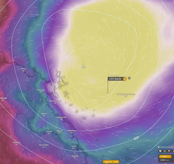
One potential scenario has severe TC Kirrily impacting the Whitsunday region of Qld. Image via Windy.com
There are also factors making predictions uncertain at this time:
- Directional Influence: Competing atmospheric conditions are creating uncertainty in Kirrily's path. A high near Fiji and an upper trough near New Zealand will attempt to drag Kirrily to the southeast, while a mid-level ridge across inland Australia will try and drag Kirrily west onto the Queensland coast.
- Forecast Split: Predictions vary between a westerly and southeasterly trajectory post-Monday.
While a direct impact on Cairns or surrounding areas is not anticipated, the combination of Kirrily's trajectory and recent heavy rainfall post-Tropical Cyclone Jasper raises concerns. Local governments and communities are advised to stay alert.

Potential steering mechanisms for Tropical Cyclone Kirrily. Image via WeatherWatch
Our Services in Action:
In this context, our advanced weather alerting services become indispensable for informed decision-making:
- Tropical Cyclone Alerts: Real-time updates on Kirrily’s development, trajectory, and intensity.
- Severe Weather Alerts: Comprehensive alerts encompassing potential high winds, heavy rainfall, and associated risks.
- Lightning Alerts: Crucial for outdoor safety management, especially for transport and large retail sectors.
- Custom Forecasting: Tailored insights for specific regions and industries, aiding in proactive planning and risk mitigation.
- Flood Monitoring: Continuous observation of flood-prone areas, essential for local governments and insurance agencies.
Stay Prepared with Us:
Our commitment is to provide precise, timely, and actionable weather information to assist your operations and emergency planning. Stay ahead of the curve with our specialized weather alerting solutions.
For ongoing updates on Tropical Cyclone Kirrily and to learn more about our services, Contact our Team.