A silent whisper of the name Jasper has been the talking point in Queensland over the past few days, without a tropical cyclone even forming. Such is the interest for the potential early-season storm to impact the Queensland coast, with various models quickly picking up a southern Wide Bay and Burnett, South East Queensland, or even far northern NSW coastal crossing.
This scenario appears highly unlikely to eventuate, with the focus now shifting to central and northern areas of Queensland.
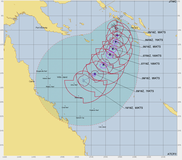 Tropical Cyclone Jasper's forecast, spread, and intensity. Image via Tropical Tidbits
Late Tuesday afternoon, the Bureau of Meteorology officially named Tropical Cyclone Jasper, which developed west of Honiara in the Soloman Sea, as a category one system.
At the time of writing Jasper is currently a category two system, but is expected to intensify into a severe category 3 or 4 system by Thursday into Friday, with wind gusts over 220km/h, and adopt a southwesterly trajectory towards Queensland, with the help of an upper ridge cradling the system west towards Queensland.
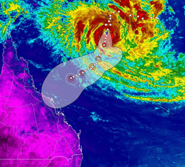
Category 2 Jasper via Satellite imagery this morning - with extended BoM track map. Image via via WeatherWatch
By Saturday, Jasper will be well entrenched in the Coral Sea and is expected to pass to the east of Willis Island. The situation becomes more complex during this period with Jasper’s speed, intensity, and positioning variables beyond the immediate future. However, there is firm ensemble guidance that Tropical Cyclone Jasper will impact the Queensland coastline early to mid-next week, with a potential crossing beginning to focus between Cooktown and St Lawrence.
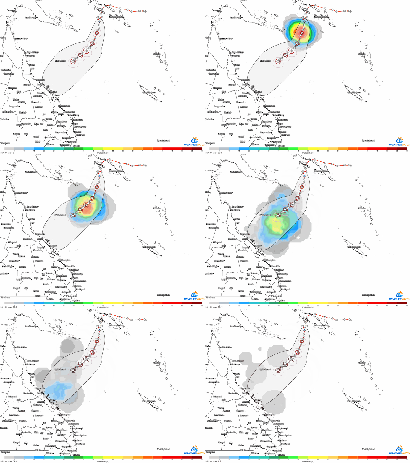
Tropical Cyclone Jasper forecast track and probability (%). Gif via WeatherWatch
Jasper’s presence will be unappreciated across this region, bringing the threat of destructive wind gusts. However, there’s a silver lining. Rainfall would increase with a potential crossing, and parts of the moisture-starved Herbert and Lower Burdekin, Mackay and Whitsunday, Capricornia Coast, and Wide Bay and Burnett region chomping at the bit for further renewed rainfall after an impressive November.
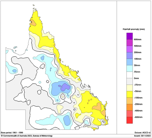
3-month rainfall anomalies for Queensland. Image via BoM
Should Jasper cross the coast, heavy rainfall leading to flash flooding and riverine flooding would be expected, with falls of 200-400mm possible at its crossing. GFS and EC currently paint a worst-case scenario: Jasper crossing between Cairns and Townsville.
Low-lying coastal regions would also see a storm surge impact the area.
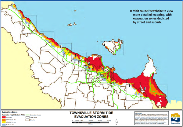
Townsville Storm Tide Evacuation Zones. Image via Townsville Council
The size of any storm surge would also depend on Jasper's intensity and if it were to cross the coast at high tide.
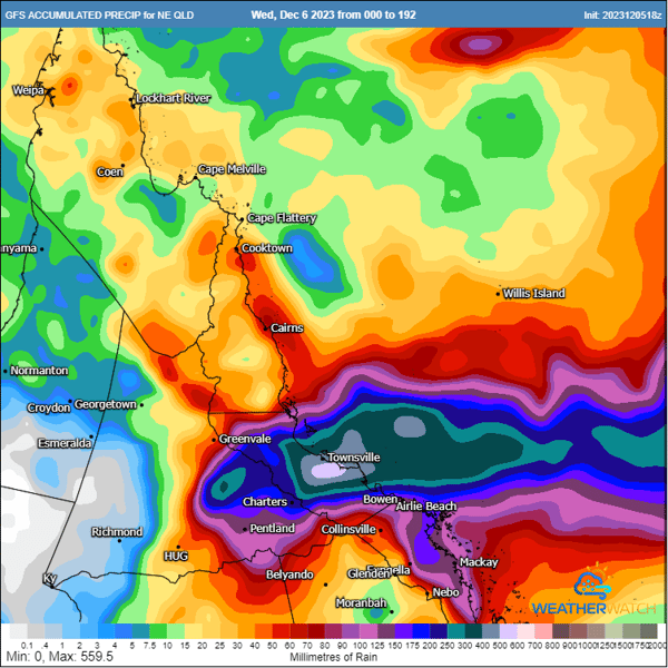
GFS accumulated rainfall totals next 240 hours. Image via WeatherWatch
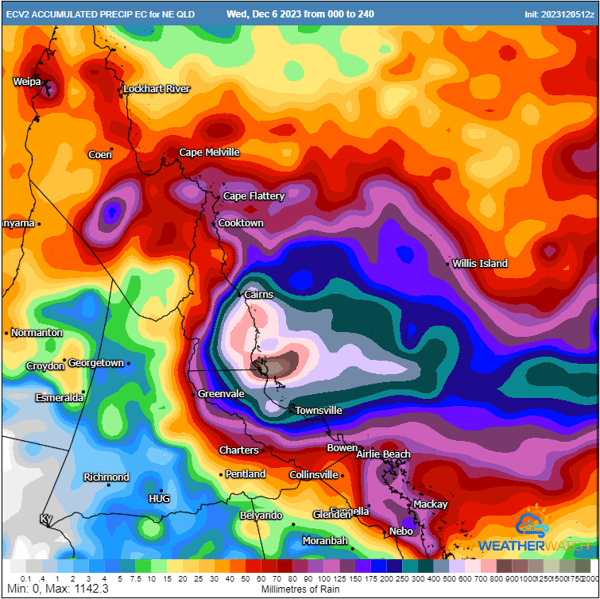
EC accumulated rainfall totals next 240 hours. Image via WeatherWatch
Should Jasper cross the Queensland coast, it will be the first cyclone to impact the eastern Queensland coast in December since Tropical Cyclone Tasha, which arrived on Christmas Day 2010. A coastal crossing would make Jasper just the 4th cyclone to impact eastern Queensland in December since 1970 (Tasha 2010, Joy 1990, Una 1973, and Althea 1971) and just the 8th December cyclone to hit eastern Queensland since 1916!
In fact, should Jasper cross the eastern Queensland coast before the 18th of December, it will set a new record for the earliest cyclone crossing for eastern Australia!